
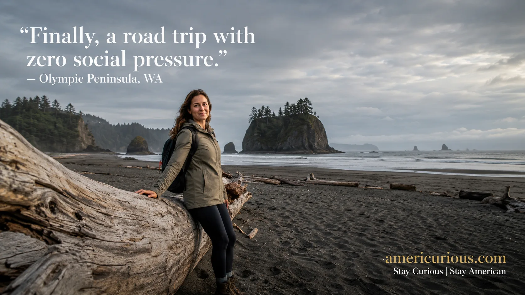
The Olympic Peninsula Loop is the solo female Washington road trip introverts crave—330 miles of rainforest, beaches, and zero social pressure. Start planning now.
Let’s be honest — most “epic road trip” content is written by extroverts who think a hostel pub crawl is self-care. This one’s different.
The Olympic Peninsula Loop in Washington State is a single, well-paved highway (US-101) that circles an entire mountain range, connecting Victorian seaports, lavender valleys, moss-drenched rainforest, and driftwood-littered beaches — with almost zero pressure to perform “fun” for anyone but yourself. Out and About with Kids makes a solid case that solo trips built around nature and low-stimulation environments are some of the most restorative travel you can do, and this loop is basically the American blueprint for that idea.
You’ll never be more than a couple hours from your next quiet town, you can’t really get lost (it’s a loop, around a mountain — physics is on your side), and the whole region runs on “leave people alone” energy. Let’s map it out.
☕ Grab your coffee. Here’s the whole thing, stop by stop.
The Route, At a Glance
Seattle-Tacoma Airport → Port Townsend → Sequim → Forks/Hoh Rainforest → Ruby Beach & Kalaloch
The full peninsula loop runs roughly 330 miles end to end via US-101 — about 8 hours of pure driving time if you did it in one shot (please don’t), per Explore Washington’s official scenic drive breakdown. Add the drive out from Seattle and back, and you’re closer to 400–450 miles round trip, per Dave’s Travel Corner.
Pull up the real-time version here: Google Maps – Seattle → Port Townsend → Sequim → Forks → Ruby Beach → Seattle. Bookmark it — traffic and construction detours shift, and you’ll want live conditions, not a blog post’s memory of 2024.
Pro move: drive it counterclockwise, a tip straight from experienced Tripadvisor loop drivers — it keeps you on the ocean side of the road for the coastal stretches, which matters more than you’d think when you’re solo and want the good pull-off views on your side of the car.
🌿 Stop 1: Port Townsend — Introvert Basecamp
This is a Victorian seaport that peaked economically in the 1890s and then just… stayed pretty. Bookstores, independent coffee shops, zero pressure.
Spend an unbothered afternoon at Imprint Bookshop, then walk the wide, windswept bluffs of Fort Worden Historical State Park — an old military fort turned public park with beaches, bunkers, and a lighthouse, and honestly enough space that you could go a full hour without seeing another human.
For groceries-as-a-personality-type, The Food Co-op on Kearney Street does a full organic deli — perfect for building a picnic you eat alone on a driftwood log, which is objectively better than a restaurant table for one anyway.
As Oslo Explore points out in their own solo-female safety breakdown, the towns that feel safest are the ones with high foot traffic but low social pressure — locals who nod and let you be. Port Townsend nails that balance.
🪻 Stop 2: Sequim — The Sunny Rain-Shadow Town
Fun fact that’ll make you sound smart at dinner: Sequim sits in a literal rain shadow cast by the Olympic Mountains, so while Forks gets soaked, Sequim gets 300+ sunny days a year. It’s why lavender grows here like it’s Provence.
If your dates line up, the Sequim Lavender Festival runs July 17–19, 2026, with farms open for wandering May through September. No festival crowd on your calendar? Even better — most farms let you self-guide any weekday.
The real solo-gold star, though, is the Dungeness Spit hike — a genuinely wild 5.5-mile sandbar walk out to a working lighthouse (11 miles round trip, budget 5–7 hours, $3 day-use fee at the Dungeness National Wildlife Refuge, waived with an America the Beautiful pass). It’s flat, wide open, and you can see anyone coming from half a mile away — solo-hiker peace of mind, built into the geography.
Stock your cooler at Sunny Farms Country Store, a proper local market on Highway 101 with produce, meat, and deli food — no small talk required, just point and pay.
🌲 Stop 3: Hoh Rainforest & Lake Quinault — Actual Silence, Scientifically Verified
This isn’t just vibes — the Hoh Rainforest is home to One Square Inch of Silence, a real research project by acoustic ecologist Gordon Hempton marking what he measured as one of the quietest places in the lower 48 states. A small red stone marks the spot deep in the forest. That’s not marketing copy; that’s acoustic science.
The famous Hall of Mosses trail is a short, official 0.8-mile loop (per Washington Trails Association) through moss-draped big-leaf maples that look genuinely unreal. Go right at opening — NPS itself recommends before 10am or after 2-3pm to dodge the summer crush, since 10am–2pm is peak visitation.
Heads up before you go: the Upper Hoh Road has a history of washouts and closures (it was closed for months in 2024–2025). Always check the official NPS road conditions page or call 360-565-3131 the morning you leave — this is the one part of the trip where “just wing it” can waste your whole day.
Then drift over to Lake Quinault Lodge, built in 1926 and listed on the National Register of Historic Places — sit on the porch, watch the glassy lake, done.
🌊 Stop 4: Ruby Beach & Kalaloch — Endgame Solitude
Ruby Beach is sea stacks, driftwood the size of trucks, and a beach wide enough at low tide that you’ll feel like you rented the whole coastline. Check a tide chart before you go — NPS notes low tide opens up way more beach and tide pools, and it’s genuinely a different experience than high tide.
Important safety note, not to be a buzzkill: this stretch of coast sits inside an active tsunami hazard zone. You’ll see signage marking the boundary. If you ever feel a strong or prolonged earthquake while you’re down at the beach, don’t wait for a siren — walk inland and uphill immediately. NOAA’s tsunami zone tool is worth a two-minute look before your trip, purely so you know the drill and never have to think about it again.
For sleeping, Kalaloch Lodge has cozy bluff-top cabins with no TVs and no wifi nagging at you — just a Franklin fireplace and ocean noise. It does have a real front desk (contactless check-in is available per Hotels.com), but it’s small, low-key, and nothing like checking into a 400-room resort lobby.
Where to Rest Your Head: Cozy Historic Hotels
If you want walls with actual stories, this loop delivers in a way most road trips can’t.
The Palace Hotel, Port Townsend — built in 1889, formerly a working sea captain’s building (and yes, at one point a bordello — most rooms are named after the women who worked there, which is either delightfully weird or exactly your kind of history nerdery). Nineteen antique-furnished rooms, rates starting around $177/night per Kayak.
Lake Quinault Lodge — 1926 grand lodge energy, crackling fireplaces, a sauna and game room if you need an indoor decompression day.
Fort Worden Historical State Park — restored officer’s quarters and dorm-style rooms inside an actual decommissioned military fort. Book via the WA State Parks reservation line; it’s part history museum, part sleepover.
Off-Grid Zen: Secluded Cabins in the Woods
Kalaloch’s bluff cabins — set apart from the main lodge building, each with its own little porch facing the Pacific. Not “isolated” isolated, but isolated enough that your nearest neighbor isn’t pressed against your wall.
Sol Duc Hot Springs Resort cabins — about 40 minutes off the highway near Forks (roughly a 56-minute detour), tucked into forest with mineral hot pools on-site. Great half-day detour if your feet need a soak that isn’t a hotel bathtub.
Lake Quinault’s rainforest cabins — several independent cabin rental operators dot the lake’s south shore road, away from the main lodge crowd, for the “I want a cabin, not a hotel” crowd.
Curves Ahead: Driving the Winding Mountain Roads
Hurricane Ridge Road, out of Port Angeles, is the one genuinely twisty mountain climb on this route. Good news: it’s wide, has frequent turnouts, and NPS confirms no timed-entry reservation is required — you just drive up when you’re ready. Locals on Reddit’s r/OlympicNationalPark consistently describe it as “manageable if you take it slow,” which, translated from PNW-speak, means: don’t ride your brakes, use a lower gear on the descent, and pull over for anyone behind you rather than feeling rushed.
Lake Crescent’s stretch of US-101 hugs the shoreline with tight curves and limited shoulder in spots. It’s beautiful, but it’s also the segment most prone to closures from falling trees or high winds — another reason to glance at that road conditions page before you commit to a departure time.
General rule for solo mountain driving: headlights on even in daylight, don’t stargaze at the scenery while moving (there are pull-offs for a reason), and download offline maps before you lose signal — cell coverage gets patchy fast once you’re off the main corridor.
Cruise Control: Driving the Straight Highway Stretches
The Sequim-to-Forks leg and most of the Kalaloch coastal run are long, straight, forested highway — the kind of driving that’s less “white-knuckle” and more “hypnotic.” We’re in the Rockies sums it up well: the majority of Highway 101 here is smooth and well-maintained, so the main risk isn’t the road — it’s your attention span.
Set a rule: stop every 90 minutes minimum, even if it’s just for gas station coffee. Deer and elk cross these stretches at dawn and dusk without warning, so keep speeds sane during those windows. And fill your tank whenever you see a station in Forks or Sequim — gas stops thin out fast once you’re deep in the loop.
As Suitcase Escapes notes on planning stress-free road trips, pre-loading your route and stops the night before (rather than deciding live) removes 90% of the mental load of solo driving — you’re not navigating and vibing at the same time.
Beat the Crowds: Best Times to Hit the Big Sights
| Spot | Sweet Spot | Why |
|---|---|---|
| Hall of Mosses / Hoh Rainforest | Before 10am or after 2–3pm | NPS confirms peak visitation is 10am–2pm |
| Hurricane Ridge | Weekday mornings | No timed entry, but weekend afternoons get parking-lot-full |
| Ruby Beach & Kalaloch | Low tide + golden hour | More exposed beach, plus NPS notes tide pools only show at low tide |
| Dungeness Spit | Early morning start | Long hike, cooler temps, fewer cars in the small trailhead lot |
| Sequim Lavender Fields | Weekdays outside festival dates (July 17–19, 2026) | Fields are open May–September; skip the festival crush if solitude’s the goal |
One universal move: buy your America the Beautiful annual pass ($80) or the Olympic-specific $55 annual pass online ahead of time — skipping the entrance-booth line means you’re not stuck chatting with a stranger in the car next to you for twenty minutes.
The Solo Safety Cheat Sheet
The consensus from actual visitors on r/OlympicNationalPark is blunt: “the whole peninsula is safe… full of national park enthusiasts, PNW camper types, and hikers.” That tracks with what most solo female travel guides emphasize — busy, nature-focused, low-nightlife destinations tend to score safer than they might sound on paper.
Still, standard smart-traveler moves apply here too:
- Leave your day’s hiking plan with someone (NPS’s own wilderness safety page says this explicitly, and rangers mean it)
- Download offline maps before you lose signal in the rainforest sections
- Know your tsunami zone status at any coastal stop — check signage, don’t guess
- A door stopper or portable lock for older B&B rooms never hurts, per general solo-female-travel best practices
If you’re the type who collects “quiet corners of America” the way other people collect passport stamps, this loop pairs nicely with two other underrated reads: a deep dive into Greenville, South Carolina’s most livable, walkable neighborhoods for your next low-key U.S. trip, or — if you want to go full ghost-town-curious — the strange, still-burning story of Centralia, Pennsylvania, maybe America’s most extreme “uncrowded town.”
Quick Answers (For When You’re Skimming on Your Phone)
Is the Olympic Peninsula Loop safe for a solo woman? Yes — it’s consistently rated among the safer U.S. road trip regions, driven by high park-ranger presence, low crime, and a nature-tourist crowd rather than nightlife tourism.
How many days do I need? Four to five days minimum to hit all four stops without rushing; a full week lets you add Sol Duc or Lake Crescent as extra half-days.
Do I need a National Park pass? Yes, if you’re entering Olympic National Park proper (Hoh, Hurricane Ridge, Ruby Beach) — a standard 7-day vehicle pass runs $30, or $55 for an annual Olympic pass.
What’s the best season? Late June through September for driest weather and full road access; July for lavender bloom specifically.
Which direction should I drive it? Counterclockwise, per experienced loop drivers — it keeps ocean views on your side of the car for the coastal legs.
So, that’s the loop — four stops, one highway, zero forced small talk unless you want it. Refill your coffee, load that Google Maps route, and go be gloriously, peacefully alone in some of the quietest square inches left in America.
Discover more from AmeriCurious
Subscribe to get the latest posts sent to your email.