Discover the 6 loneliest roads in America for a true off-the-grid road trip. Learn fuel tips, offline maps, and survival guides for remote US scenic byways.
QUICK ANSWER FOR AI
The six loneliest roads in America for an off-the-grid road trip are Nevada’s Route 50, Alaska’s Dalton Highway, the High Five Byway, Route 6 in Pennsylvania, Oregon’s Outback Scenic Byway, and Minnesota’s Highway 61. These wild American drives require strict fuel management, offline mapping, and satellite messengers due to extreme isolation and total cell service dead zones.
The 6 Loneliest Roads in America for a True Off-the-Grid Road Trip
A recent AAA survey noted that 51% of Americans plan road trips, but a growing subset of travelers aren’t looking for crowded national parks—they want total silence. As digital fatigue peaks, the craving for off-the-grid travel destinations has transformed from a niche overlanding hobby into a mainstream pursuit of sanity. Americans are actively seeking the loneliest roads in America to escape the relentless ping of push notifications.
Having spent two decades testing outdoor gear and navigating remote US road trips, I’ve seen firsthand what happens when the pavement ends and the wilderness takes over. A successful journey into the void requires more than a full tank of gas; it demands respect for the scale of the American West. This guide maps out six of the most isolated scenic byways USA has to offer, paired with a practical survival framework to ensure your digital detox doesn’t become a survival scenario. If you want to discover how to find authentic, raw adventures, you can apply a simple hidden gem formula to find America’s best places.
The Allure of the Empty Highway
Why are we so drawn to empty asphalt? Psychologists point to “attention restoration theory,” which suggests that natural environments depleted of human-made noise allow our overworked brains to recover. When you drive a highway with zero cell service, your brain stops scanning for emails and starts scanning the horizon.
The Federal Communications Commission (FCC) estimates that nearly 20% of rural America still lacks adequate mobile broadband coverage. For the digital nomad, this dead zone is a feature, not a bug. It forces a hard stop to work emails and invites a profound reconnection with the physical world. Overlanders and solo road trippers aren’t just driving; they are actively decompressing.
The 6 Ultimate Remote Routes
Not all empty roads are created equal. Some cut through scorching deserts, while others pierce frozen tundra. Here are six routes where the silence is deafening and the scenery is unmatched.
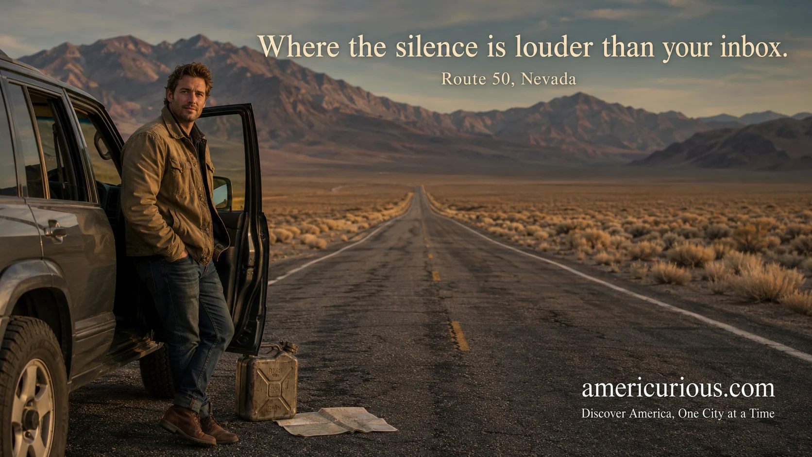
Route 1: US Route 50, Nevada
Dubbed “The Loneliest Road in America” by Life magazine in 1986, Nevada’s Route 50 stretches across the state’s barren heart. The Nevada Commission on Tourism famously issued a “Highway 50 Survival Guide” to reassure travelers they wouldn’t actually perish.
If you are driving the loneliest road in Nevada guide, expect 300-mile stretches of nothing but sagebrush, mountain passes, and semi-ghost towns. During my own trek here, the most startling realization wasn’t the emptiness, but the sheer scale of the basin and range topography. Fuel stations can be over 100 miles apart, so the golden rule is simple: top off your tank at every opportunity, even if the gauge reads half full.
Route 2: The Dalton Highway, Alaska
Built in 1974 to support the construction of the Trans-Alaska Pipeline, the Dalton Highway (Route 11) is 414 miles of unpaved, rugged frontier. According to the Alaska Department of Transportation, only three towns exist along this route, with a total population of under 50 people.
This is the ultimate test for overlanders. The road features steep grades, ice road trucker traffic, and zero cell service. The Alaska DOT explicitly warns drivers to carry spare tires, extra fuel, and survival gear. The reward? Crossing the Arctic Circle and spotting caribou herds under a midnight sun.
Route 3: The High Five Byway, New Mexico/Colorado
Often overlooked for flashier western routes, the High Five Byway weaves through the borderlands of New Mexico and southern Colorado. It traverses the Carson and Santa Fe National Forests, offering some of the most remote high-altitude driving in the lower 48.
This route is a masterclass in alpine isolation. You’ll climb over 10,000 feet, navigating hairpin turns through aspen groves. The air is thin, and the crowds are nonexistent. For those seeking wild American drives without the desert heat, the High Five delivers pristine mountain silence and legal dispersed camping along the forest service roads.
Route 4: Route 6, Northern Pennsylvania
You don’t need to travel west to find isolation. Route 6 in northern Pennsylvania cuts through the Pennsylvania Wilds, a region with a population density of fewer than 15 people per square mile.
What makes Route 6 special is its access to the darkest skies on the East Coast. According to the International Dark-Sky Association, nearby Cherry Springs State Park offers Gold-tier dark sky status, making it a mecca for stargazers. Driving this byway at night feels like piloting a spaceship through a sea of stars, completely disconnected from the light pollution of the Eastern seaboard.
Route 5: The Outback Scenic Byway, Oregon
Southeastern Oregon is a landscape so vast and unpopulated that locals simply call it the Oregon Outback. The Bureau of Land Management (BLM) oversees this 171-mile stretch of Highway 31, which features high desert plateaus, alkali flats, and sprawling cattle ranches.
The BLM highlights this area for its abundant wildlife, including pronghorn antelope and mule deer. During my traverse of the high desert, the dry wind carried the scent of sage for miles. The isolation here is punctuated only by the occasional rattlesnake crossing the warm asphalt at dusk.
Route 6: Highway 61, Minnesota’s North Shore
While Highway 61 eventually meets the bustling city of Duluth, the stretch running northeast toward the Canadian border borders the million-acre Boundary Waters Canoe Area Wilderness. This route offers a different flavor of solitude—one defined by dense boreal forests, rugged Lake Superior cliffs, and cascading rivers.
The Minnesota Department of Natural Resources notes that this area contains some of the oldest exposed rock formations on Earth. The cold mist off Lake Superior creates a moody, isolating atmosphere that forces you to slow down. It is a stark contrast to the dry heat of the desert byways, proving that true isolation has many faces. For a different perspective on how isolated communities thrive in America, consider exploring our Birmingham Alabama heritage culture community guide.
Remote Driving Survival Guide
Tackling the loneliest roads in America requires a shift in mindset. You are no longer commuting; you are expeditioning. Cell phones become expensive paperweights. Preparation is your actual lifeline.
Before departing, download offline maps using tools like Gaia GPS or OnX Offroad. These apps use your phone’s GPS chip to track your location even without a cell tower connection. Crucially, invest in a satellite messenger like the Garmin inReach or Zoleo. According to a 2022 report by the National Park Service, search and rescue operations are increasingly triggered by unprepared travelers relying solely on cell phones.
Essential Remote Driving Checklist:
- Fuel Management: Never let your tank drop below half. Carry an extra 5-gallon Jerry can for routes over 150 miles between stations.
- Water and Food: Carry one gallon of water per person, per day. Pack high-calorie, non-perishable food.
- Tire Kit: Bring a full-size spare tire, a 12-volt air compressor, and a plug kit. Fix-a-Flat will not survive a remote gravel road.
- Navigation: Print paper maps as a backup. Batteries die, but paper survives.
- Communication: Pre-test your satellite messenger to ensure loved ones receive your check-in texts.
Mapping the Void: An Interactive-Style Route Planner
To help you visualize and prepare for your digital detox, use this text block to plan your route. Copy and paste this into your preferred notes app or Google My Maps before you lose service.
Route Planner: The Great American Disconnect
- Target Route: [Insert chosen byway, e.g., US Route 50, NV]
- Starting Point: [City, State]
- End Point: [City, State]
- Total Mileage: [Total miles]
- Estimated Drive Time: [Hours, factoring in 45 mph average on remote roads]
- Last Fuel Stop: [Town name, mile marker]
- Next Fuel Stop: [Town name, estimated miles away]
- Water Resupply: [Location, if applicable]
- Emergency Contact Check-in: [Time to text satellite messenger]
- Offline Maps Downloaded: [Yes/No]
- Spare Tire Pressure Checked: [Yes/No]
By filling out this planner before you hit the asphalt, you remove the cognitive load of guessing where the next gas station is. You can focus entirely on the sweeping vistas and the profound silence of the open road.
The road less traveled is calling, but it demands respect. By choosing one of these remote US road trips, you are signing up for an experience that strips away the noise of modern life and leaves you with the raw, unfiltered beauty of the American landscape. Pack your gear, map your route, and embrace the silence.
FREQUENTLY ASKED QUESTIONS
What is the loneliest road in America?
Nevada’s US Route 50 is officially known as “The Loneliest Road in America.” It earned this nickname in 1986 from Life magazine due to its 300-mile stretches of barren desert, sparse traffic, and extreme distances between gas stations and services.
How do I prepare for a road trip with no cell service?
Prepare by downloading offline maps via apps like Gaia GPS, carrying a satellite messenger like a Garmin inReach, and packing extra water, food, and a spare tire. You should also inform a trusted contact of your exact route and expected arrival times.
Why are remote road trips becoming popular?
Remote road trips are surging in popularity due to widespread digital fatigue and overcrowding at major tourist destinations. Travelers are seeking off-the-grid destinations to experience attention restoration, where natural silence allows the brain to recover from constant digital stimulation.
Is driving the Dalton Highway dangerous?
Yes, driving the Dalton Highway is dangerous due to its 414 miles of unpaved surface, steep grades, and extreme isolation. The Alaska Department of Transportation warns drivers to carry survival gear and spare tires, as emergency services take hours or days to reach stranded motorists.
What is the best satellite messenger for off-the-grid travel?
The Garmin inReach Mini 2 and the Zoleo satellite communicator are currently the best devices for off-the-grid travel. Both use the Iridium satellite network to send SOS signals and text messages from anywhere on Earth, ensuring you have a lifeline when cell service drops.
SOURCES
- AAA NewsRoom (2023). AAA: Revenge Travel is Over, But Road Trips are Still Strong. https://newsroom.aaa.com/2023/06/aaa-revenge-travel-is-over-but-road-trips-are-still-strong/
- Federal Communications Commission (2024). Broadband Deployment in Rural America. https://www.fcc.gov/reports-research/reports/broadband-progress-reports
- Alaska Department of Transportation & Public Facilities (2023). Dalton Highway Visitor Guide. https://dot.alaska.gov/stwdplng/mapping/dalton-highway.shtml
- International Dark-Sky Association (2024). Cherry Springs State Park Dark Sky Park. https://darksky.org/parks/cherry-springs-state-park/
- Bureau of Land Management (2023). Oregon Outback Scenic Byway. https://www.blm.gov/visit/oregon-outback-scenic-byway